Difference between revisions of "Auburn50BikeRide"
From Troop792Wiki
Jump to navigationJump to search
| (15 intermediate revisions by the same user not shown) | |||
| Line 2: | Line 2: | ||
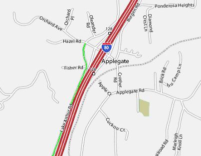
* Start at Applegate (above Auburn, where Crother Rd and Orchard Ave. crosses I-80). | * Start at Applegate (above Auburn, where Crother Rd and Orchard Ave. crosses I-80). | ||
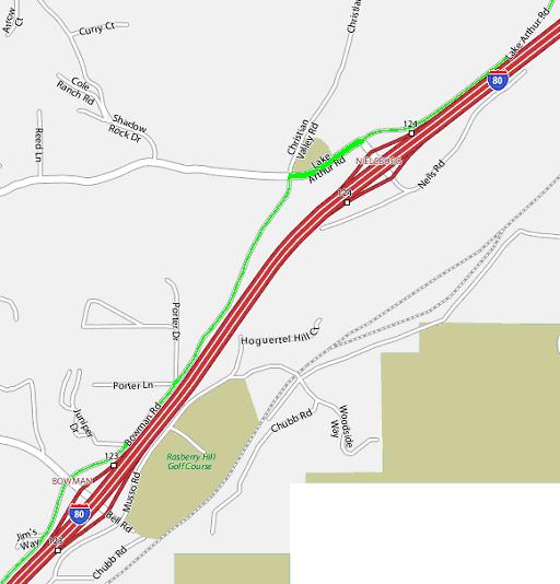
* Take Lake Arthur Rd (4.2 mi) | * Take Lake Arthur Rd. (for 4.2 mi) SW. | ||
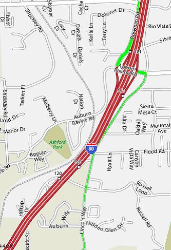
* | * L on Bowman Rd. (2.7 mi) | ||
* | * L on Auburn Ravine Rd (cross I-80) | ||
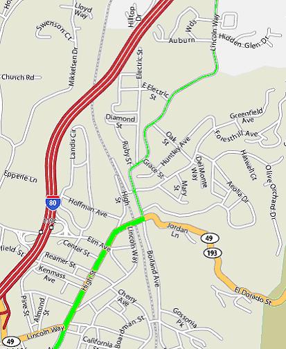
* | * R on Lincoln Way (2.1 mi) | ||
* | * R El Dorado St. (0.2 mi) | ||
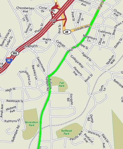
* | * becomes High St. (0.9 mi) | ||
* to American River Bike Path. This makes 26.1 miles. | * L on Auburn Folsom Rd. (16.0 mi) | ||
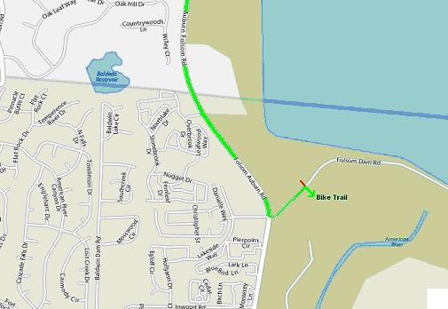
* L on Folsom Dam Rd. | |||
* to American River Bike Path (38.706124,-121.169638) on right. This makes 26.1 miles. | |||
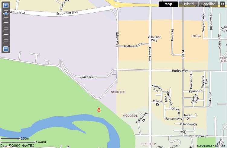
* Then continue on the Bike Trail until the 6-mile marker (38.588832,-121.420006). | |||
Notes: | |||
* The Trail is almost flat but is still slightly downhill. Head winds can make this part some work. | |||
* Elevation change ~2000ft | |||
* Go to the 6-mile marker to complete 50 miles. Pick-up vehicles park at the end of Ethan Way. | |||
[[File:Auburn50a.JPG]] | |||
[[File:Auburn50b.JPG]] | |||
[File:Auburn50g. | [[File:Auburn50c.JPG]] | ||
[[File:Auburn50d.JPG]] | |||
[[File:Auburn50e.JPG]] | |||
[[File:Auburn50f.JPG]] | |||
[[File:Auburn50g.JPG]] | |||
Latest revision as of 06:41, 6 April 2010
50-mile bike ride from Auburn to Sacramento
- Start at Applegate (above Auburn, where Crother Rd and Orchard Ave. crosses I-80).
- Take Lake Arthur Rd. (for 4.2 mi) SW.
- L on Bowman Rd. (2.7 mi)
- L on Auburn Ravine Rd (cross I-80)
- R on Lincoln Way (2.1 mi)
- R El Dorado St. (0.2 mi)
- becomes High St. (0.9 mi)
- L on Auburn Folsom Rd. (16.0 mi)
- L on Folsom Dam Rd.
- to American River Bike Path (38.706124,-121.169638) on right. This makes 26.1 miles.
- Then continue on the Bike Trail until the 6-mile marker (38.588832,-121.420006).
Notes:
- The Trail is almost flat but is still slightly downhill. Head winds can make this part some work.
- Elevation change ~2000ft
- Go to the 6-mile marker to complete 50 miles. Pick-up vehicles park at the end of Ethan Way.
